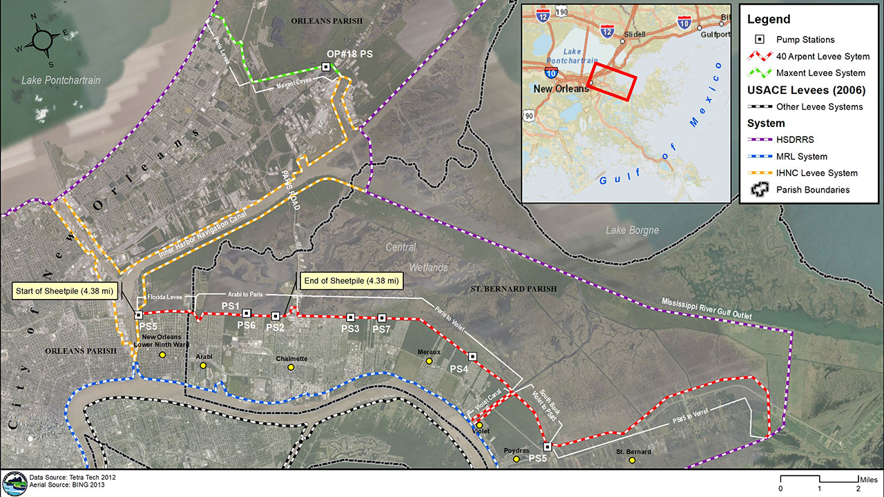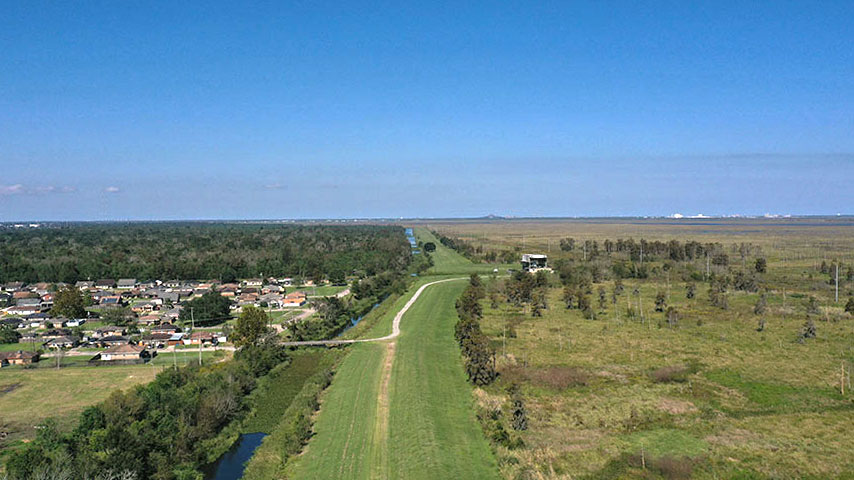
On behalf of the Authority, our team completed the full scope of work for the certification of this system, which includes 24 miles of earthen levee system, 5 miles of steel sheet pile floodwall, 7 pump stations, and 5 closure structures. The initial inspection of all system features informed what analyses were needed (wave, geotechnical, and structural) as well as the current performance of the levee system. At project completion, Tetra Tech documented the final condition of the system by integrating the Authority’s drone aerial survey, which was supported by our Tetra Tech Delta expertise, with a physical validation and calibration field inspection.
During the initial inspection, the team identified the need to rehabilitate one mile of levee along the Violet Canal. The levee was realigned, and closure structures were incorporated at the east and west limits to enable maximum operation time of local businesses during flood events. Our team performed environmental evaluation and permitting and benefit cost analyses to support a grant application under the Community Development Block Grant program. The project was awarded the full requested amount, which significantly offset the cost of construction.
This project was submitted to FEMA for accreditation of the levee system based on the inspection, design, and analysis performed by Tetra Tech. The accreditation will allow thousands of area residents to purchase low-cost insurance based on the reduction in risk provided by the levee.
Benefits
- Violet Canal improvements provided flood protection and enabled maximum business operation
- Enhanced flood protection within Orleans and St. Bernard Parish
- Supported FEMA flood insurance compliance
- Drone inspection to create a historical condition record