Leading with Science® and leveraging our technology
Combining industry-leading technology expertise and in-depth operational knowledge
Tetra Tech Delta delivers solutions that combine science and engineering expertise with advanced analytics and technology. Our interdisciplinary teams collaborate with our clients to create customized, sustainable, and scalable solutions to address their most challenging problems.Featured Tetra Tech Delta subscription solutions
Tetra Tech Delta encompasses the advanced data analytics, artificial intelligence (AI), and digital technologies that we have designed to provide transformational solutions for our clients.
We create solutions that answer client needs—from smart data collection and advanced analytics that support decision-making to automated intelligent processes and secure cloud solutions that modernize operations. Tetra Tech Delta solutions provide AI-powered insights that can optimize asset management, increase resiliency, and reduce risk.
Tetra Tech Delta builds on 60 years of research and industry-leading, technology-driven experience that serve as the foundation for the solutions we are providing to our clients today. Tetra Tech’s interdisciplinary experts understand the challenges our clients face and how to leverage technology to solve them.
Unparalleled insight
Transformational solutions
The Delta difference
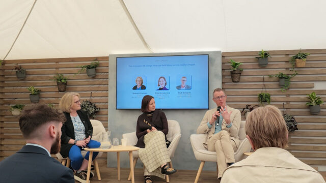
Innovative solutions, practical applications
Tetra Tech uses our Leading with Science approach to create technology solutions that combine our industry-leading technology expertise and in-depth operational knowledge into practical offerings.
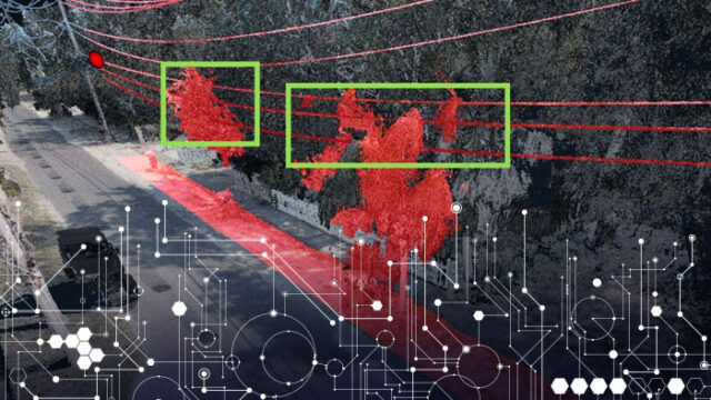
FusionMap: Unleashing the power of data using AI-powered insights
50% time savings for modeling and inspections
Tetra Tech’s FusionMap is an innovative and flexible web-based platform that transforms how users can access, manage, and visualize their geospatial data. FusionMap integrates custom AI models to extract actionable intelligence from various data sources. Its comprehensive asset management, immersive 360-degree imagery, and augmented reality capabilities further enhance the user’s ability to explore data, making FusionMap a leader in AI-powered geospatial data management.
- 50% reduction in time spent on 3D modeling and inspections
- Expanding library of more than 45 AI models tailored to client requirements
- Near-real-time LiDAR change detection of thousands of miles of roads, highways, and rail tracks with millimetric accuracy
- 365/24/7 fully automated flood monitoring of more than 2,000 miles of assets from coast to coast
- More than 70 terabytes of processed, analyzed data from satellite vendors updated weekly
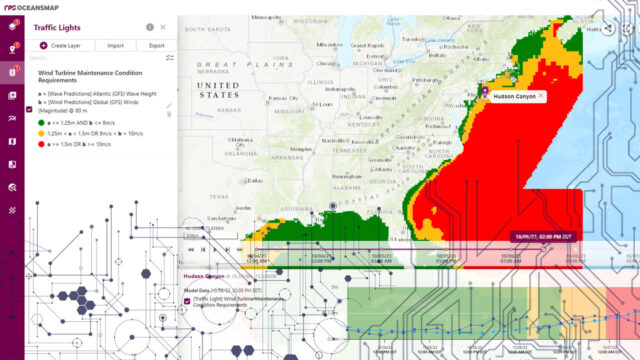
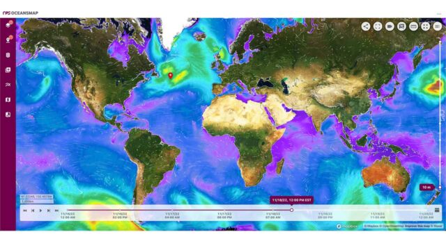
OceansMap: Leveraging an ocean of data for informed decision-making
600+ environmental data sources with global and regional coverage
OceansMap is designed specifically to overcome the challenge of combining complex environmental data from disparate sources and integrating impactful tools. It fosters collaboration, provides a common operational picture, and facilitates data-driven decision-making. Tailored experiences create insights, inform decisions, and unleash the power of data.
- 600+ environmental data sources with global and regional coverage
- Evolving library of 25+ widgets and visualization and analysis tools
- Customizable insights dashboards for monitoring and planning
- Instantaneous MetOcean analysis at critical locations for informed operations
- Dynamic update of latest forecast and observation data
- Advanced cloud-native data management system with quality assurance/quality control
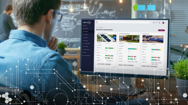
myProjects: Simplifying data capture and reporting
Up to 25% effort saved across the life of a project
Tetra Tech’s myProjects is a secure, cloud-based project management tool with an intuitive, easy-to-use interface that can be customized according to program and project requirements, providing a single source of truth.
- Up to 25% effort saved across the life of a project
- 6,000+ projects supported globally with $26 billion in project value
- Supported by program and project management experts
- Accurate real-time reporting and insights to drive informed decision-making
- Interactive capability and easy integration into existing systems
- Facilitates transparency, consistency, and collaboration between teams and stakeholders
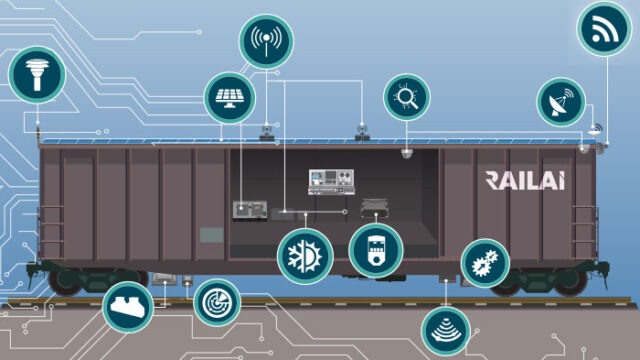
RailAI®: Improving safety and producing faster results
16 times greater inspection rate
Our RailAI solution uses AI and automation to modernize rail track inspection, improving safety and efficiency. The RailAI autonomous railcar operates uncrewed and provides real-time track condition data for immediate and preventative maintenance.
- AI-powered autonomous data collection
- Real-time processing at 70 miles-per-hour survey speed
- 24/7 fully automated track inspections
- 5 times the functionality at 1/5 the cost per mile of human-operated systems
- 16 times greater inspection rate than traditional methods
- 50% reduction in visual inspections
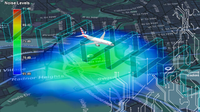
Volans: Improving decision-making and communication with 3D air traffic visualization software
10 times faster noise and emissions impact calculations
Volans® is visually stunning, easy-to-use, and functionally rich software that supports stakeholder engagement and data-driven decision-making. Tetra Tech’s proprietary and patented 3D visualization software enables users to study environmental and noise impacts near airports, design new departure and arrival procedures, perform air safety studies, create video presentations for education and community outreach, and analyze air space restrictions and obstructions. Volans is an integral technology supporting airspace modernization in the United States and the United Kingdom.
- Rapid 3D analysis of flight tracks and takeoff and landing procedures
- Sophisticated video creation capabilities to assist in outreach and education
- Calculates environmental impact of both existing activities and proposed designs
- 10 times speed increase in calculating noise and emissions impact at major airports
- 3D visualization websites enable governments to inform and engage the public on nationwide airspace modernization
- Visual comparison of airspace changes and local and regional impacts
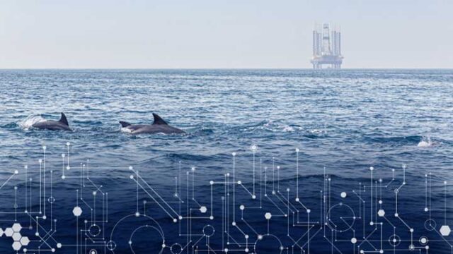
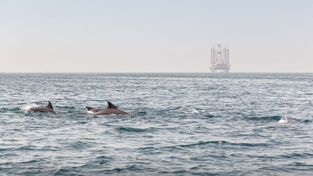
Neptune AI: Leveraging high-end AI software to detect marine mammals
96% accuracy detecting calls of vulnerable whale species
Tetra Tech’s Neptune AI is a high‑end, AI‑powered acoustic monitoring system that detects and classifies marine mammal vocalizations with industry‑leading accuracy in challenging offshore environments. Developed for real‑time mitigation monitoring, Neptune was trained on actual sound recordings from complex sea conditions to reduce false positives and support protected species monitoring and compliance.
- Patented AI method for real-time marine mammal detection and classification
- Trained on offshore noise conditions to reduce false positives
- Minimizes data transmission volume and analyst workload
- Designed for use across buoys, unmanned vehicles, and towed acoustic systems
- Awarded the 2025 Oceantic Ventus Innovation of the Year Award
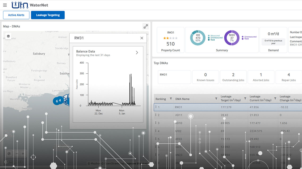
WaterNet: Streamlining data and asset management for the water industry
30+ out-of-the-box integrations for analyzing multiple data sources
WaterNet™ integrates data from multiple sources into actionable insights to streamline water utility asset management, operational efficiency, and regulatory compliance. This comprehensive data collection, management, and analysis tool features advanced analytics within a customizable solution that helps clients reduce leakage and provide a robust water management package.
- Real-time analytics to enable efficient water distribution and leakage control
- In-depth consumption analysis to optimize water usage
- Robust leakage and non-revenue water calculations that meet local and international standards
- User-friendly browser platform simplifies decision-making for all water utility staff, supplemented by our detailed analytics platform
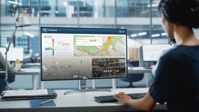
HydroWeb: Deliver operational intelligence for smarter infrastructure and environmental management
Up to 90% efficiency improvement for data management and reporting
HydroWeb is an intuitive and intelligent platform that integrates smart data wrangling, real-time monitoring, GIS, digital twins and advanced data analytics within a secure and scalable cloud environment to provide customized insight. HydroWeb has addressed some of the most challenging problems for water, environment, and sustainable infrastructure programs for decades.
- Real-time stormwater and wastewater collection system tracking and management
- Automated rainfall analysis with storm tracking and impact prediction
- 24/7, real-time modeling and AI enable advanced analytics for flood warning, water system alerts, and water quality monitoring
- Customized dashboards provide georeferenced decision support
- 20+ applications supporting water, environmental, and infrastructure solutions
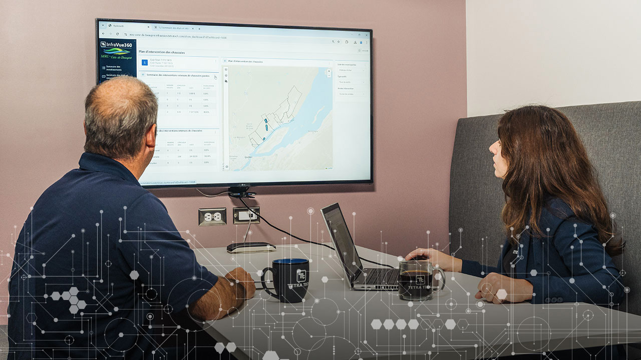
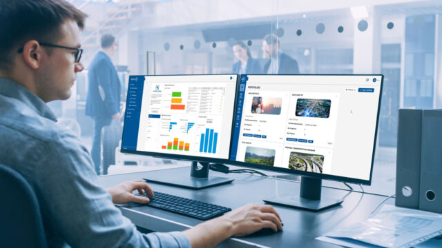
InfraVue360™: Optimize asset management and investment with centralized data and visualization
50% improvement in asset planning and decision-making
The InfraVue360 platform integrates and automates the processing of large volumes of asset data, creating a reliable operational foundation that enables your teams to make informed decisions and optimize investments. The customizable platform centralizes and consolidates data from multiple sources, transforming fragmented data sets into actionable intelligence to optimize investments in alignment with infrastructure strategies.
- 90% reduction time to consolidate all relevant data through automated process of the data-agnostic platform
- Simulation tools optimize investment strategies by modeling various options
- Simple and scalable tool to track asset inventory, conditions, strategic and operational KPIs, and investment progress
- Intuitive visualization enhances stakeholder communication and public transparency
- Supports, connects, and integrates the latest data collection technologies and AI-powered processing