OceansMap unlocks the power of data to deliver clear, connected, and actionable ocean insight for critical marine operations.
In coastal and offshore environments, operations teams, emergency responders, and environmental planners often face time-sensitive decisions based on complex, fast-changing ocean conditions—while also working with environmental data scattered across disparate sources.
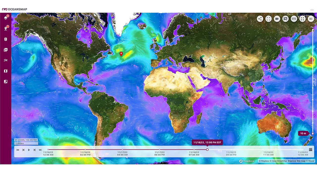
Tetra Tech’s web-based metocean data platform, OceansMap, brings clarity to that complexity by turning fragmented datasets into operational intelligence. It provides a real-time view of oceanographic, meteorological, and environmental data to support management, analysis, and operational decision-making.
Delivering an integrated metocean data ecosystem
OceansMap centralizes access to complex datasets from more than 600 global and regional sources, including public and proprietary feeds. Tetra Tech’s environmental data services technology processes and standardizes these inputs so they can be readily used for analysis, modeling, and visualization. This enables faster, more coordinated responses across government, energy, emergency response, environmental services, and recreation sectors.
Simplifying maritime planning, response, and data analysis
OceansMap draws on more than 40 years of modeling expertise, combining Tetra Tech’s science and engineering capabilities with software innovation to deliver advanced visualization and analysis tools. Key capabilities include:
- Data services: Automatically collects and processes real-time, forecast, and historical data
- Collaboration tools: Supports role-based access and shared workspaces for coordinated response
- Customizable insights dashboards: Tailored to regions, assets, or mission needs
- Integrated modeling tools: Supports oil spill and search-and-rescue simulations with built-in applications
600+
environmental data sources with global and regional coverage
25+
visualization and modeling metocean analysis tools
24/7
forecast and observation data for real-time decision-making
Together, these tools bring teams together under a shared operational picture—helping users act quickly, reduce risk, and gather critical information.
Trusted by government and industry partners globally
OceansMap supports critical decision-making in sectors where timing, accuracy, and collaboration matter most:
- Government agencies manage hazard planning and interagency coordination using centralized data, analytics, and visualization tools
- Energy operators plan and operate in complex ocean environments with integrated software that supports safe, efficient offshore operations
- Response teams deploy faster using real-time forecasts and modeling tools
- Environmental specialists turn complex data into actionable insight to support risk assessments, monitoring, and management
- Recreation and tourism agencies publish near real-time forecasts to protect public safety and coastal infrastructure
Watch the video below to learn more about Tetra Tech’s OceansMap technology.
Get started with OceansMap
OceansMap makes metocean data management easy, and it can be configured for single‑site pilots or scaled enterprise deployments. Our experts work with your team to integrate local and regional data, customize insights dashboards, and validate modeling workflows.
Contact our team to request a demo or explore how OceansMap can support your marine operations and deliver mission-ready ocean intelligence.