Tetra Tech’s comprehensive approach to acquiring, processing, and analyzing survey and mapping grade data helps our clients better manage the earth’s resources, improve strategic planning, and facilitate design and decision-making.
We work closely with our customers throughout the project to understand their unique requirements and to mitigate risks (schedule, cost, and regulatory) by employing the optimum personnel, technologies, and sensors suited to the given task. Our ability to rapidly turn around data deliverables, often on-site during data collection, sets us apart from our competitors. Our unique capability enables real-time, strategic decision-making in the field.
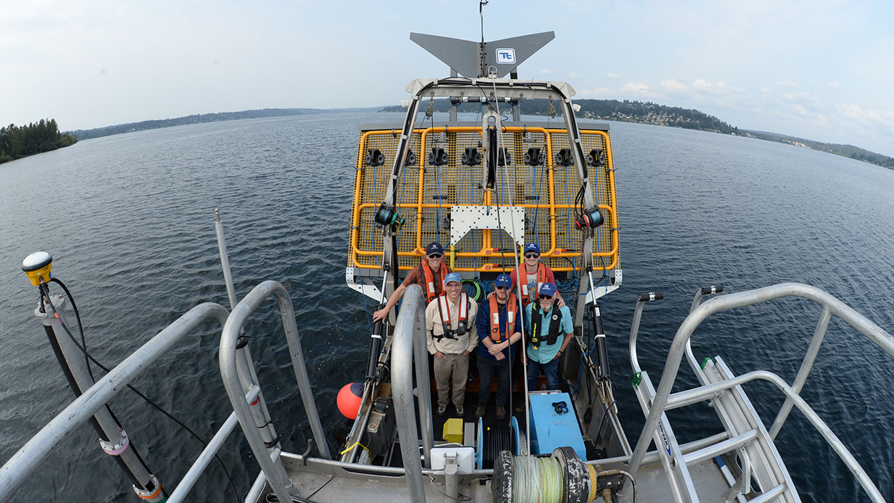
Hydrographic, Marine Geophysical, and Oceanographic Surveys
Tetra Tech delivers complex hydrographic, geophysical, and oceanographic survey services tailored to the specific needs of our clients. Our vast at-sea experience spans from shallow water (<1 meter [<3 feet]) to deep water (>5,000 meters [>16,000 feet]) and has resulted in numerous successful projects throughout the world.
Hydrographic surveys
LiDAR and underwater imagery, high-density laser scans
Marine geophysical surveys
Metocean studies
Archaeological, environmental, and geotechnical studies
Terrestrial Geophysical Surveys
Tetra Tech geophysicists specialize in high-resolution 3D seismic and gravity imaging for various applications. These include detection of mine voids, subsurface karst imaging, fracture and fault mapping, hydrological and environmental applications, geothermal applications, mining applications, structural monitoring, earthquake engineering inputs, and ground motion prediction. Our staff have extensive experience in geologic data interpretation, including 3D modeling of data and interpreted results.
3D seismic and gravity investigation, subsurface mapping
Subsidence risk evaluations for karst and abandoned mines
Infrastructure geohazard risk evaluations
Geologic characterization and geotechnical evaluations
Seismic hazard assessment and ground motion evaluations
Dam foundation investigations, safety evaluations, and compliance monitoring
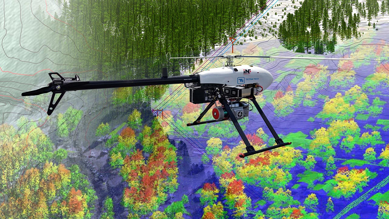
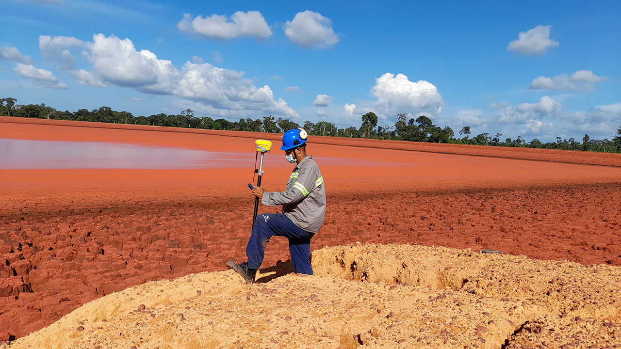
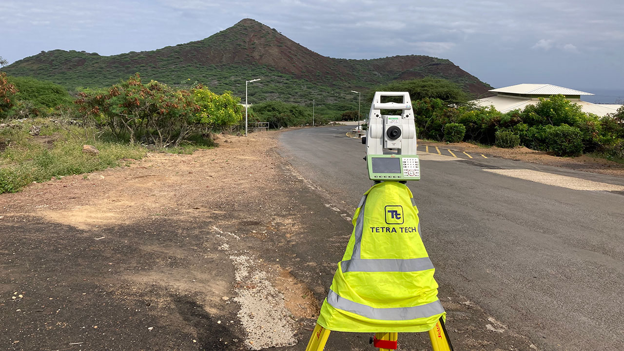
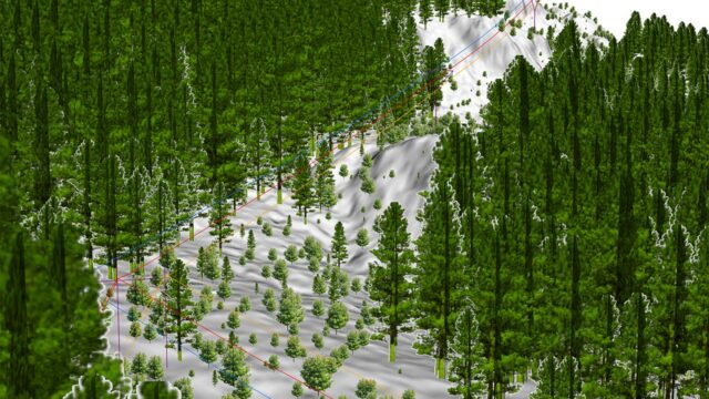
Topographic Surveys and Remote Sensing
Tetra Tech is a leading provider of integrated mapping solutions for airborne, mobile, and terrestrial projects. With our expertise in advanced mapping software, sensors, camera systems, and information technology infrastructure, we offer comprehensive services in air, land, water, and desktop mapping. We have an impressive industry track record, with our seasoned experts specializing in planimetric and topographic mapping, orthoimagery, LiDAR, multispectral and hyperspectral technology, mobile mapping, and laser scanning.
Satellite imagery collection and analysis
Land survey
Unmanned aerial data collection systems
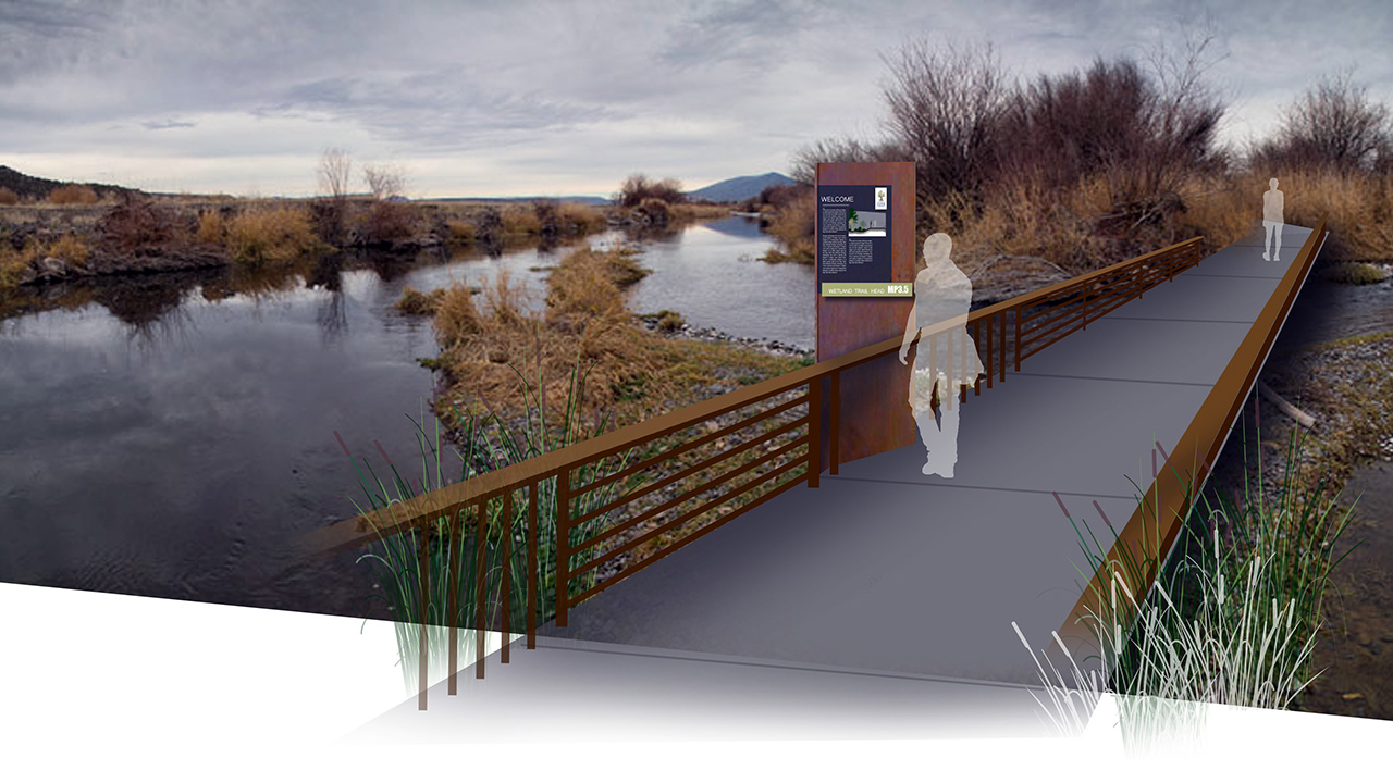
Modeling and Data Visualization
Tetra Tech’s visual resource staff provides a complete range of products and services, including visual impact assessments, visual simulations, illustrative graphics, architectural renderings, video, animation, public outreach materials, visual concepts of operations (CONOPS), and interactive 3D environments. Our graphics help convey complex topics to clients and stakeholders, clearing roadblocks for project approvals.
Animations and videography
Mobile and interactive technology
Graphic design
Technical infographics
Visual simulations
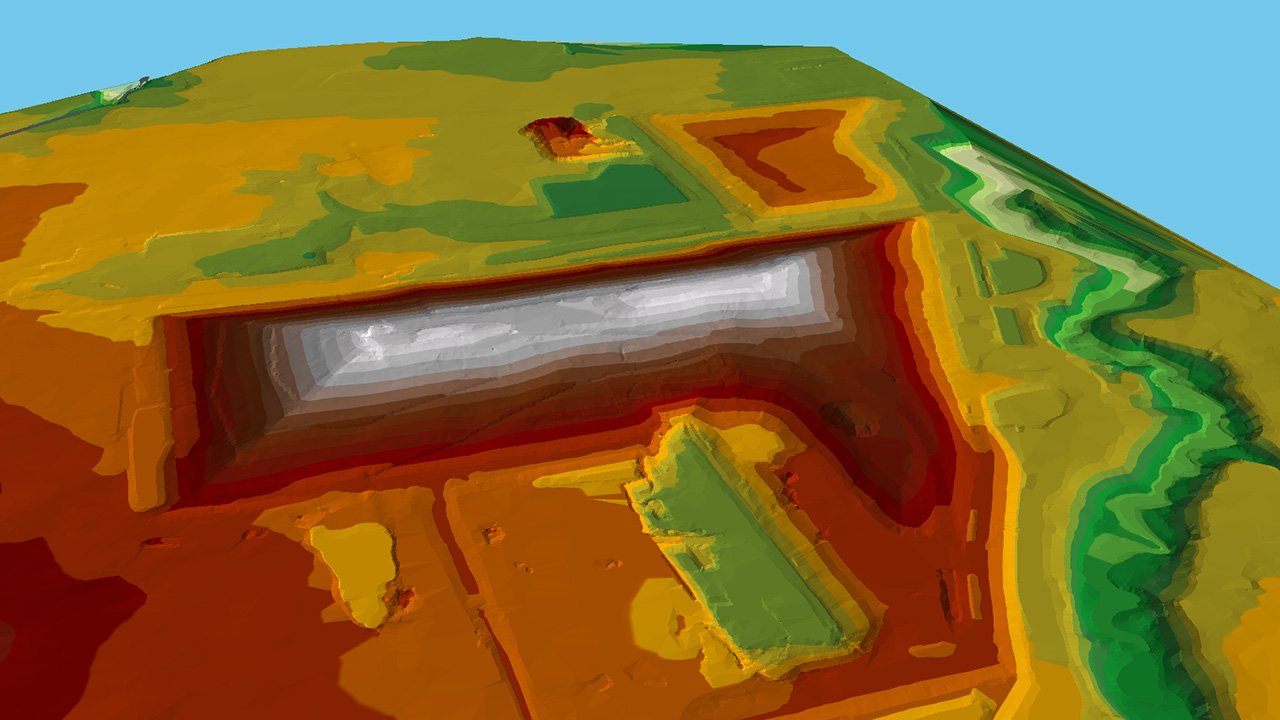
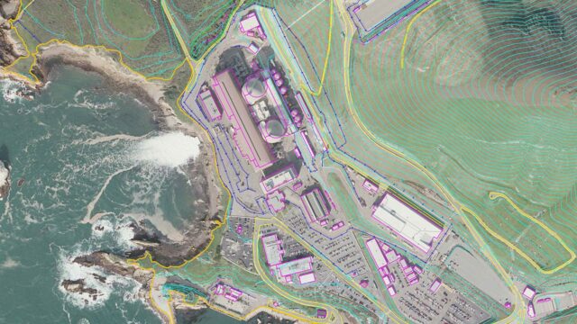
GIS and Mapping
Tetra Tech is an industry leader in the innovative use of geographic information systems (GIS) technology. Our analysts produce site maps and illustrations while managing large, multi-disciplinary environmental datasets. We are highly experienced in GIS and database automation, applications programming, spatial modeling, 3D modeling, advanced image analysis, and interactive web mapping.
Application development and programming
3D and spatial modeling
Mobile mapping solutions
Asset management
Geodatabase design
Cartography and map template design
Web-based GIS and mapping
Connect with us. Reach out to our environmental solutions experts.